Inhalt dieses Beitrages
- Holiday homes on the island of Mön
- Bed & Breakfast on the island of Mön
- camping
- Mon island map
- Mon island cliff
- Arrival to the island of Mön
- Climate / weather
- Chalk cliffs on the island of Mön – A natural wonder
- The GEO Center Möns Clint
- Moen – A paradise for nature lovers
- The largest chalk cliffs in the world – a comparison
- Video from GEO Center Moens Clint
The island of Mön. An idyllic island, surrounded by wet and white chalk cliffs that shine in the sun shrouded in mystery. To the northeast of Falster, in beautiful Denmark, is the island of Moen. The destination can be compared with the island of Rügen, because both have a lot in common, but the island of Moen is much quieter and exudes something heavenly.
With the Scanlines ferry you can easily sail from Rostock from to Gedser and finally arrives at Denmark’s most beautiful island. However, the destination of the journey can also be reached via bridges and dams. Holidays on the island of Moen, in a cozy holiday home, in the midst of the beautiful climes and close to the sea, is very relaxing and beneficial.
Holiday homes on the island of Mön
The typical Mön vacationer books a holiday home. There are around 300 holiday homes on the island. So you should book well in advance.
>> List of selected vacation homes
Bed & Breakfast on the island of Mön
Bed & Breakfast is becoming increasingly popular with guests. There is a lot on offer there – from breakfast, a picnic basket to a boat or bike rental.
>> List of Bed & Breakfast providers
camping
Camping vacationers find idyllic places on Mön to settle down. The beaches on the island of Mön are very well-kept and clean. But the crystal clear water not only invites you to take a bath. Fishing enthusiasts have long since declared the island of Moen their catching area and find a suitable place on the entire island to cast their fishing rods.
Link: Campsites on the island of Mön
If you spend your beach vacation on the island of Moen, you should use this time to explore all the secrets of the island. Because there is so much to discover here. It gets like a fairy tale in the Ulvshale forest, located in the north of Mön. Many hand-made felt figures breathe life into the fairy tale forest.
As befits a real island, the island of Moen also has a lighthouse, the Moen Fyr. This was built in 1845 and should definitely be inspected.
Moen is full of fascinations, which is why holidays on this island are so varied and beautiful.
The island of Mön is an island of Denmark and about 218 km² and is located on the Baltic Sea. This island only has around 10,500 inhabitants, but due to its wonderfully beautiful location, it is a popular holiday destination.
Radiant kilometers long Sandy beaches invite you to surf and bathe au the island of Mön, there are also beautiful forests, with heathland on the island and a hilly landscape. The forest in the north of the island in the municipality of Ulvshale is often referred to as the fairy tale forest and is well worth a visit. For vacationers who like to be active there are many golf courses and opportunities for Bike tours .
The so-called island capital of Mön is Bridges and at the same time the largest place on the island. The cozy, idyllic small town has adjusted itself very well to the tourists, you can enjoy the day and go for a stroll without the hustle and bustle.
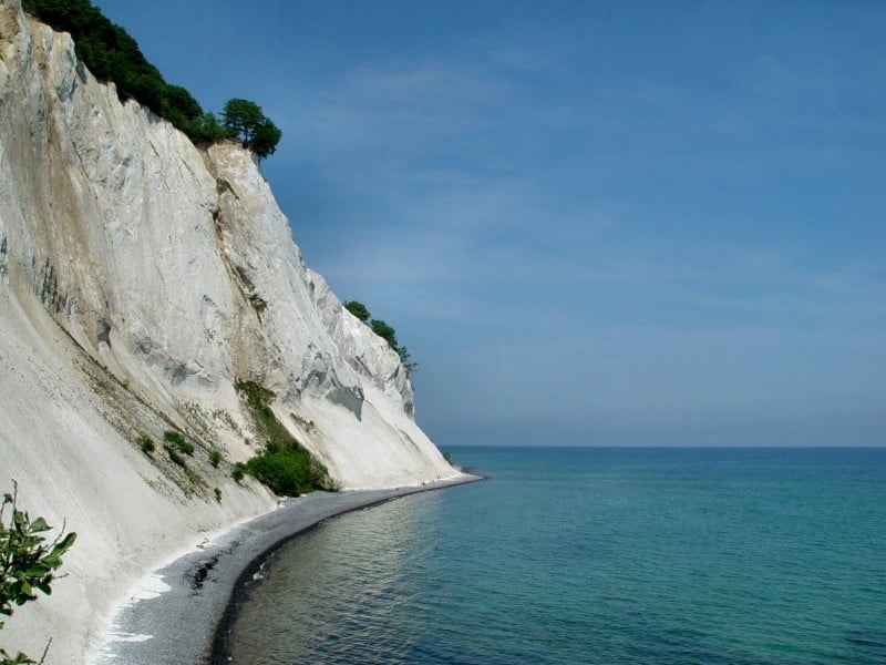
Much of the island of Mön consists of Shell limestone and that is why it is often referred to as the sister island of Rügen. The white chalk cliff and also the highest cliff is the Möns Klint. This cliff is 128 m high and 8 kilometers long, everywhere there are stairs leading down to the beach, but this is associated with a certain risk because of the danger that limestone can fall off. The wrinkled appearance of the coast changes regularly due to different weather conditions, such as sun, rain, frost and ice. It is the main attraction on the island and attracts thousands of visitors annually.
The island of Mön has even more to see, such as beautiful churches in Damsholte, Kildeby and in the Fanefjord bay.
Mon island map
[osm_map_v3 map_center=”54.965,12.295″ zoom=”10″ width=”100%” height=”450″]
Mon island cliff
Also well worth seeing and in the immediate vicinity of the Möns steep coast Sounds is the park and the castle of Liselund . Both invite you to linger and take a look. The interior of the castle is not always open to the public. At first glance one would consider this property to be a typical country house, the impression is gained from the narrow spiers, the whitewashed outer walls and the thatched roof. The beautiful park invites you to take long walks and offers a view of the sea.
These are just a few of the romantic sights Mön Island . It has a lot more to offer and that is one reason why many holidaymakers keep choosing this island as their holiday destination.
Arrival to the island of Mön
This island can be reached very easily with the various Ferry connections and over car bridges . The best and cheapest car ferry connections are from Germany to the island of Falster and from there to the island of Mön. It is also possible to drive to this island via the Storebält Bridge, built in 1998, or the Faroe Bridge.
Link: Location and arrival to the island of Mön
Climate / weather
No matter what time of year you visit the island of Mön, it always exerts its certain charm. The summer there is only very short from June to August, the daily sunshine duration is 7.4 hours on average. The temperatures during the day are around 19 to 25 degrees and the water temperatures around 20 degrees. In summer you get the feeling that it doesn’t get dark.
The temperature on the island of Mön rarely drops below freezing point even in winter.
Chalk cliffs on the island of Mön – A natural wonder
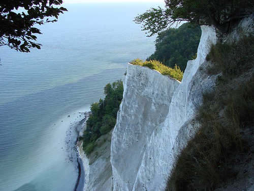
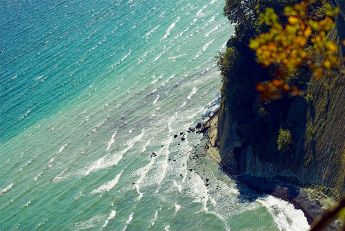
One of the most famous and spectacular natural phenomena of the Danish Baltic island of Mön undoubtedly count the chalk cliffs Möns Klint (Cliffs of Moen), which can also be called the highest cliff in Denmark. The dreamlike and incomparable scenery of these limestone giants draws countless visitors to the Danish island year after year, whereby, by the way, Mön also has beautiful sandy beaches and other sights to offer. Those who want to marvel at the huge limestone giants can view their entire length either from above from the beech forest or from below from the beach.
Some of the enthusiastic observers of these gleaming white chalk cliffs of Möns Klint also compare them with monumental cathedrals made of stone, which rise dignified and awe-inspiring from the sea. Because the almost 130 meter high chalk cliffs in the otherwise rather flat Denmark definitely rank among the group of high mountains. The limestone wall is about six kilometers long and even reaches a point of about 143 meters in the hinterland. For nature lovers, these dazzling white limestone rocks with their unique contrast to the jade green color of the Baltic Sea form a breathtaking and unforgettable sight.
The ancient chalk giants have, believe it or not, almost 75 million years on their chalky-white backs. During the formation process of the chalk cliffs, countless different microscopic animals were deposited on the bottom of the sea. When, after millions of years, the sea receded and the continents rose, the first mountains were created at the same time. The sea floor rose and the chalk cliffs were exposed. During the last ice age, the rocks were given their present-day shape by the movement of glaciers. Precipitation, frost and wind then gave them the finishing touches in the last millennia.
The GEO Center Möns Clint
Anyone who spends their vacation on Mön and would like to learn more about the Cretaceous Period and the formation of the white rocks has been able to visit the Geology and Nature Center Geo Center Möns Klint, which can be found roughly in the middle of the cliff, for several years. Using state-of-the-art computer technology on interactive screens, a lot of interesting and worth knowing information about the geological formation of Denmark and the chalk cliffs is explained in a way that is easy to understand, even for children. Likewise, landslides can be simulated in large experimental and showcases or the postponement of the chalk layers with the help of the glaciers in the Ice Age can be simulated on mountain models.
Furthermore, the Geo Center is the ideal starting point for exploring around Möns Klint. The view of the chalk formations can be enjoyed wonderfully on well-laid paths along the edge of the forest. However, even on these forest trails, a number of meters in altitude have to be conquered again and again. Some very dangerous places were secured by wooden fences, but by no means all. So if you are not completely free from vertigo, you should definitely keep a little distance at these points, because sometimes it goes 100 meters very steeply into the depth.
There are several well-arranged wooden stairs for the descent down to the beach, with the main staircase right next to the Geo Center. With this descent possibility there are always opportunities to rest, some of which even give a view of the Baltic Sea. Once you have reached the beach, you can of course climb up the wooden stairs to the beech forest or admire the white rocks from the beach.
As beautiful and overwhelming as the white chalk cliffs of Mön are, they still have their downsides. Because the quite soft limestone is subject to constant erosion, which is very spectacularly noticeable. As a result of the very wet winter months, for example, in the spring of 2007 two of the mighty rock peaks collapsed into the Baltic Sea with half a million tons of chalk, gravel, clay and uprooted trees. A chasm with ruins, a small chapel and a waterfall were also lost. But even before this catastrophe, some devastating demolitions of this extremely sensitive structure took place. However, the catastrophe in 2007 was probably the worst crash in around 50 years.
Moen – A paradise for nature lovers
Nevertheless, the Baltic island of Mön is a true paradise for nature lovers. Lovers of rare plants get their money’s worth in the Möns Klint area in particular: around 20 different types of orchids thrive in the forests behind the chalk cliffs, for which the calcareous soil naturally offers ideal living conditions. If you want to admire this variety of orchids in full splendor and bloom, it is best to visit the island of Mön between the months of May to August and explore the unique nature with all its sights.
The largest chalk cliffs in the world – a comparison
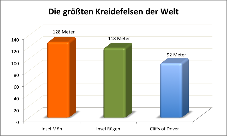
If you compare the largest chalk cliffs in the world, the chalk cliffs cut the Mön Island not bad … They are in first place in terms of height. On the island of Rügen there are also chalk cliffs, which are, however, much smaller and less impressive. On the island of Rügen, however, there is an elevation that still exceeds the highest point of Mön. It is the Piekberg with 161 meters. On the island of Mön, the Aborrebjerg is “only” 143 meters high.
In the same stroke of Stevens-Klint, from north to south, at most with a gentle bend to the south-south-east, Möens-Klint also continues and from its mere geographical position it can be seen that both were connected before the bay from Höjstrup to Jurigshoved collapsed and the islands were segregated by a sea tide advancing to the southwest. Such separations can only be ascribed to violent overturning, for the ordinary effect of nature is healing, covering everything sharp, rounding off everything angular.
The aim here is to reconnect the two countries through an increasing extension of Ulfshdle, as is already evident.
Möens-Klint and its immediate surroundings were previously separated from the current western part of the island. In 1510 a sea battle between the Danes and the Hanseatic League was fought in an arm of the sea that cut the current island at Borrekirche from south to north. Borre Church was destroyed on this occasion, and its reconstruction imposed a peace condition on the Hanseatic League. A lot of burial mounds to the west are written from the time of this event. Now a valley is expanding in the same direction, its bottom is entirely sea sand, in some places covered with a thin layer of peat, there are still small, half-dried bodies of water in which, however, mostly freshwater fish live, and the dam that separates the valley from the The lake sheds so little that the latter falls over during storms in winter.
To the west of this valley, a small row of hills runs parallel to Moens-Klint, the base of which is unknown to me, but which, after the sedimentation of the waters, seems to be asleep, seems to be limy. Immediately under the plant soil lies sand, clay and marl. In Nörrevestudmark alone there is a superficial limestone defeat, which corresponds perfectly with the bulbous, eroded limestone of Faxoe. Even the beds of blue clay very close by have balls of thick lime mixed in with them.
To the east of the lowland lies the highest point of the island, the Kougsbjerg, on the edge of the chalk plateau, which flattens out perpendicularly with small incisions in between very gently to the northwest and west, the southern and southeastern fall of the layers and lines of the mountain range. On the summit of Kongsbjerg there is chalk stone with flint structures that have not fully matured. But they are bulbous like the flint on the southern edge.
With the chalk stone wall, which forms the actual cliff, the Kougsbjerg is so closely connected by uniformly continuous elevations that one only has to regard the intervening Thulers as grooves which were created in it by the power of the waters. Like Stevens-Klint, the mountain range is a coherent mass, and the peaks and cones which the influence of the meteors has worked out on the eastern fall are ascribed to the inflections of the slides, which here are even more irregular and undulating than in the Stevens on this system.
Sand, clay and marl are found deeper and go away from the Klint bank. The upper rancies do not fall down in layers and en masse, as they did in these, but the rain draws bare gullies, washes narrow descending thalers into the side wall, sometimes lets springs slide down under the most graceful vegetation, gradually tapering the chopped up pyramids more regularly, and produces the grotesque building above completely isolated, but connected by a continuous base cones. Large round vaults go into the sides, the upper masses threaten an instant collapse, and yet I noticed only two sinkholes, which were also broken pieces from the thorn background of already formed valleys.
In order, this cone takes Dronningstolen the first place, with a height of 472 feet, then the row proceeds through Groderen, Sommerspiret, Tragten, Graaryggen, Steilebjerg, Hvidskud, Fruerstuen Gjedebrinken and the fisherman’s house to the south, north through Vitmonds Nakke, Rode – and Sokkepibe-Udfald, Gugledalen, Taleren, Jydele.iet.nnd N otsguviene, until it ends in lovely Liselund, which, with clever use of the most graceful natural facilities, puts the most pleasing wreath on this beautiful corn and rose country.
The structure of which this terrain consists in all its extent and diversity is chalk (a, as I have designated it above, chalk in various proportions with lime and silica earth. There is no real pure chalk here. A coarse genus is located at Gjedebrinken, almost in south-sloping layers, red, yellow and brown in the interstices. So it is in Fruerstuen, with continuous layers of fiery stone bulbs, 1 to 2 feet apart, between the layers also falling to the south. The chalk stone becomes finer on Hvidskudet, the camp of which is almost vertical from sinking in to the south. The layers of flint nodules are further here, 6 to 7 feet apart, without being connected, while the stratifications continue, of which there are many without nodules. Steilebjerg’s camps fall to the south-west, as can be seen from the northernmost drop, where the heads of the layers protrude. The curvature of the flint inlays is most noticeable here on the whole Möens-KIint. The finest chalk stone can finally be found on Graaiyggen, denser, more ringing, and with no visible fossilization.
Dronningst>Ien reveals a few layers of flint, several feet apart, but they seem to be more coherent, although they are also only elongated nodules that fit more intimately into each other; for completely coherent layers, as on Stevens-Klint, do not exist in Mö’en. At Sokkepibe- and Röd-Udfaldet they are rarer, the chalk ends like pebbles and the Sandkred-Fald there are many feet of mighty clay deposits, mixed with small flint stones, pieces of granite, quartz and feldspar. The flints are now almost completely absent, for a long distance they only appear in a few places, especially on the Taleren, a finer chalk rock mountain range, remarkable because of the serpentine, almost dendritic of its lower layers of flints, which are almost horizontal on top. This phenomenon of the regular upper stratification, and the lower undulating, is more or less repeated in the whole series of these exposed rock walls.
There hardly seems to be any other way of explaining this strange stratification than if one assumes that these mountains consist of precipitates of kidney-like or artichoke-like masses, the positions of which go concentrically around one or more central points. The apparent lack of. Parallelism then rests on the way in which the external weathering rushes more or less to its core, whereby other layers emerging from their level become visible. The more regular position of the upper one is then even more understandable, because it must be regarded as belonging to the outer and therefore more even cortex, whereby even several underlying spherical systems may be included at the same time.
Petrifications have gotten pretty sidelong here in recent times. You can still find individual echinites on the beach, belem “nites in the coarser limestone. Abildgaakd mentions the gryphites and ripened mussels in the valley, otherwise the starfish. There are also pebbles of sulfur, partly or wholly weathered. In general one can make the observation that pure chalk never contains fossils (at least I have not found any in them), but that they occur only in the upper talc-like layers, which sometimes seem to consist solely of a mass made up of them .
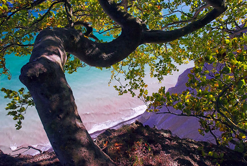
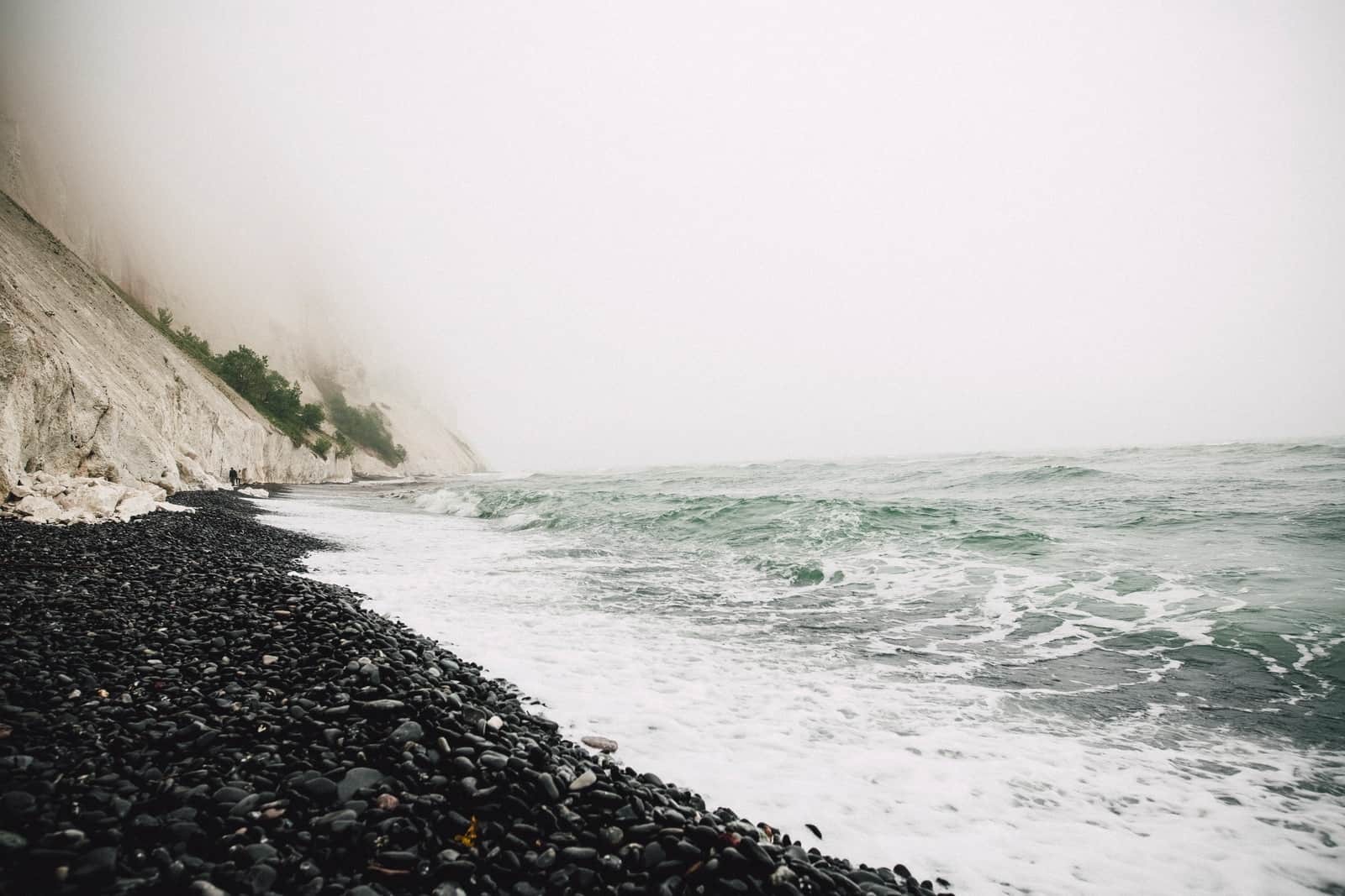
This is still Denmark! I know it’s hard to imagine Denmark could look like this, especially in December.
This special place is called Møns Klint and is extremely beautiful and special.
Denmark look great – when the sun is shining 😉
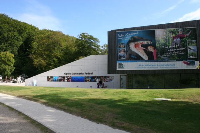
Geocenter Möns Klint is located in the southeast of the island of Møn. In this exhibition you can learn everything about the history of the ice age of Møn and the other regions affected by the ice ages. A lot of work is done with descriptive models that are especially fun for children. Children can do handicrafts, climb around on larger-than-life insect models or watch 3D films. You can even move plates and re-enact the Ice Age. There is then a nice climbing wall to loosen up. You can only fall softly here.
This center is certainly unique for Denmark – a little bit comparable perhaps with the Darwineum in Rostock, on the other side of the Baltic Sea.
Admission is not exactly cheap. However, the admission ticket is valid for the entire duration of the holiday. We have found that you can visit this exhibition several times, as it is quite extensive.
As everywhere on Møn, physical well-being is of course taken care of. The ice cream was especially delicious. Unfortunately, on our last visit in September, the bees were quite persistent.
The geocenter is located directly on Moensklint, the large chalk cliffs of Møns Klint in the middle of beautiful nature. A long staircase leads down to the stony beach on the Baltic Sea. Fossil collectors in particular get their money’s worth here. But don’t underestimate the stairs.
We hope you enjoy this exhibition in Denmark’s South Seas.
Video from GEO Center Moens Clint
Geocenter website: http://www.moensklint.dk/
Opening hours:
23.03. until October 31, 2017 – 11 a.m. to 5 p.m.
Entry per person:
Adult 115 DKK
Children from 3 to 11 years DKK 75
With the Scandlines day ticket you save up to 20% on this admission.
